Table of contents
Excavation is often framed as a necessary disruption, a blunt instrument used to unlock housing, transport links and flood defenses, yet its ecological footprint is more complicated than a simple “damage done” narrative. From wetland dredging to urban trenching for utilities, digging reshapes soils, water flows and microbial life, and those shifts can either stall recovery for decades or, under certain conditions, jump-start renewal. With regulators tightening biodiversity rules and developers facing rising scrutiny, the real question is no longer whether excavation has impacts, but which ones, how long they last and how they can be managed.
When the ground moves, life reorganizes
Excavation changes ecosystems first by changing the physical template that supports them, and the effects begin the moment topsoil is stripped or sediment is removed. In terrestrial settings, topsoil typically contains most of the seed bank, fine roots, organic matter and microbial biomass that drive nutrient cycling; losing it can set a site back to a low-fertility state, with measurable consequences for plant establishment and food webs. Soil organic carbon is also highly concentrated near the surface, and disturbance can accelerate mineralization, increasing carbon dioxide emissions while reducing the soil’s capacity to retain water and nutrients, which in turn affects resilience during heatwaves and heavy rainfall.
In aquatic and coastal environments, dredging and excavation can alter turbidity, bury benthic habitat and rework sediment chemistry, and those changes cascade through the food chain. A well-documented example is the risk of resuspending contaminants that have settled into fine sediments over decades, including heavy metals and persistent organic pollutants; once stirred up, they can become bioavailable and travel beyond the work zone. At the same time, removing compacted or anoxic layers can sometimes improve conditions if it restores hydrological exchange or removes legacy deposits that were suppressing vegetation, which is why outcomes vary so sharply from project to project.
Hydrology is the quiet driver of many post-excavation surprises. Small changes in elevation can redirect surface runoff, alter groundwater connections and shift the duration of flooding, and those shifts determine which plant communities can return, how quickly insects recolonize and whether amphibians can breed. In river corridors, channel excavation or bank work can increase shear stress during high flows, raising erosion risk downstream, while in peatlands and wetlands, cutting drains or trenches can lower water tables, accelerate decomposition and release stored carbon. These are not abstract concerns: peatlands, for example, store more carbon than all the world’s forests combined, and their disturbance can have outsized climate implications relative to the footprint of a single site.
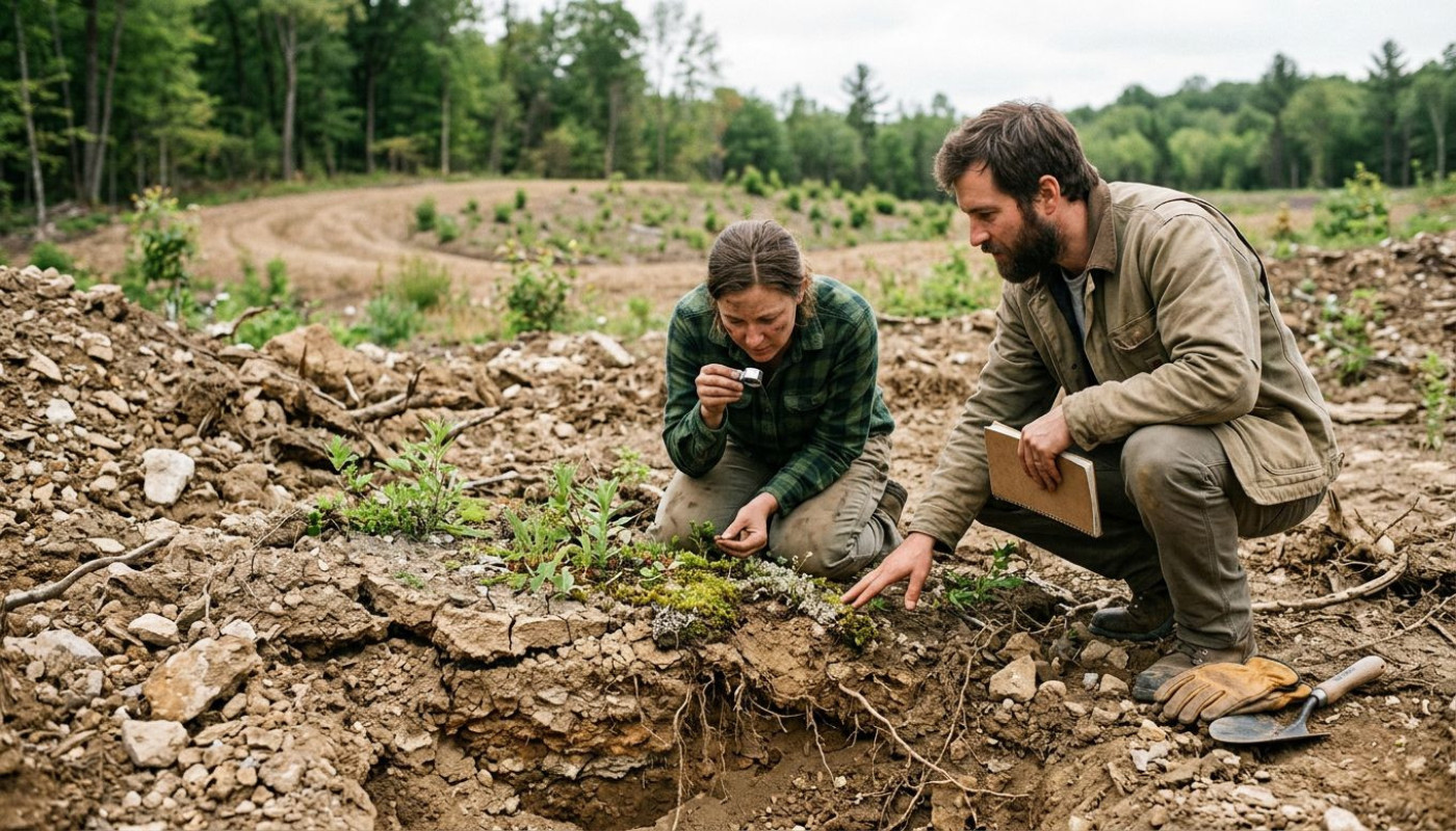
Yet ecosystems are not passive. Microbial communities reassemble rapidly, often within weeks, but not always back to their original composition; the resulting “new normal” can favor invasive plants or alter nitrogen cycling. Early successional species may colonize disturbed ground quickly, providing cover and stabilizing soil, but without careful handling of topsoil and compaction, later-stage recovery can stall. The initial excavation phase therefore behaves like a fork in the road: one path leads to chronic degradation, the other to managed disturbance that sets the stage for renewal.
Recovery is possible, but not automatic
Nature rebounds, but it does so on timelines that rarely match construction schedules. Vegetation cover can return within a season, and birds may reappear quickly, yet rebuilding complex soil structure, fungal networks and invertebrate diversity can take years, even decades, depending on the depth of disturbance and the surrounding landscape. Studies in restoration ecology repeatedly show that “visual greening” is a poor proxy for functional recovery; a site can look stable while still leaking nutrients, losing carbon or failing to support specialist species that require mature habitat features.
One of the strongest predictors of recovery is how topsoil is handled. Salvaging, storing and reapplying topsoil can preserve seeds and microbes, but storage itself can degrade quality if piles are too large, too wet or left for long periods, because oxygen declines and microbial communities shift. Compaction from heavy machinery adds another constraint, limiting root penetration and reducing infiltration, which increases runoff and sediment transport into nearby waterways. Where regulations require erosion and sediment controls, performance still hinges on execution: silt fences and settling ponds work best when aligned with site hydrology and maintained after storm events, and not treated as a box-ticking exercise.
Landscape context matters as much as on-site technique. A disturbed patch surrounded by intact habitat has a steady supply of seeds and animals, and recolonization is faster, whereas isolated sites in intensively farmed or urbanized settings can be trapped in a low-diversity state. Connectivity also influences invasive species risk, because disturbed soils and open canopy conditions create an invitation for fast-growing opportunists, and once they dominate, they can suppress native regeneration through shading, allelopathy or altered fire regimes. In wetlands, for instance, invasive reeds can form dense stands that trap sediments and change water flow, making it harder for diverse plant assemblages to return.
Policy is increasingly forcing a more rigorous view of these timelines. In parts of Europe and North America, biodiversity net gain or no-net-loss requirements are reshaping project planning, and enforcement is gradually moving from paper commitments to outcomes measured over multiple years. That shift favors excavation plans that anticipate long-term ecological function, not just immediate stabilization, and it elevates monitoring from a compliance afterthought to a central risk-management tool. In practice, it means baseline surveys, realistic recovery targets and post-works data that can demonstrate whether renewal is happening, and if not, why.
The overlooked risks: water, carbon, contamination
Ask ecologists what keeps them awake, and three themes surface again and again: water quality, carbon loss and the mobilization of pollutants. Excavation increases sediment availability, and sediment is not just mud; it can smother fish spawning grounds, reduce light for aquatic plants and carry nutrients that trigger algal blooms. Even short pulses of turbidity can stress sensitive species, and repeated events can shift entire river reaches toward more tolerant, less diverse communities. Where work intersects with streams, best practice increasingly relies on isolating the work area, timing operations to avoid spawning seasons and designing temporary diversions that do not create chronic erosion points.
Carbon is the second blind spot. Disturbing soils exposes organic matter to oxygen and microbial decomposition, and the emissions can be significant when deep organic layers are involved. Wetlands and peat soils are especially vulnerable: drainage, dewatering and excavation can convert long-term carbon sinks into sources, and rewetting later does not instantly restore the original balance. Because many carbon accounting frameworks focus on energy use and materials, these biogenic emissions can be undercounted, yet they influence a project’s real climate footprint and the feasibility of meeting net-zero targets.
Contamination risk is highly site-specific, but it is often underestimated until late. Historic industrial sites, former landfills and urban sediments can contain a complex cocktail of pollutants, and excavation can change their behavior by altering pH, redox conditions and particle size distribution. A sediment that was relatively stable under anoxic conditions can release metals when oxygenated, and fine particles can transport contaminants farther than expected. This is why modern environmental management emphasizes pre-excavation characterization, including targeted sampling, and clear decision rules for handling, treating or disposing of excavated material.
These risks are not reasons to avoid excavation altogether, but they are reasons to treat it as an ecological intervention, not merely a civil engineering step. That mindset changes the sequence of decisions: first map the sensitivities, then design to avoid and minimize, and only then rely on mitigation and restoration. It also reframes monitoring as a feedback loop, where turbidity sensors, groundwater measurements and soil testing inform adjustments in real time, rather than producing reports after the damage is already done.
How smarter excavation can help renewal
Done well, excavation can be part of a restoration strategy, especially in landscapes already degraded by drainage, compaction or contaminated fill. Removing barriers to water flow, regrading banks to reconnect floodplains or excavating legacy sediments that are choking habitats can create conditions in which native communities return more quickly and with greater diversity. In urban areas, replacing poor-quality fill with engineered soils and creating microtopography can improve infiltration, reduce heat stress and support street trees and pollinators, delivering benefits that go beyond aesthetics and into measurable ecosystem services.
The technical details are where outcomes are won or lost. Phasing work to reduce exposed soil area, keeping heavy machinery to defined routes, using low-ground-pressure equipment in wet areas and protecting salvaged topsoil from compaction can preserve the biological capital needed for recovery. In sensitive habitats, selective excavation rather than broad stripping can maintain refugia for invertebrates and microbes, and those refugia act as sources for recolonization. Where dewatering is required, controlling discharge quality and temperature, and avoiding sudden changes in receiving waters, reduces downstream stress.
Planning also benefits from tools that have become more accessible in recent years. High-resolution terrain models from drones can reveal drainage pathways and erosion risk before ground is broken, and environmental DNA sampling can help detect the presence of protected or invasive species in aquatic systems. In many jurisdictions, stronger reporting requirements and public scrutiny mean that documentation must be robust, and project teams increasingly look for practical resources and checklists to standardize best practice. For readers who want a structured way to explore approaches and services around excavation planning and implementation, check this, then compare any guidance you find with local regulatory requirements and independent ecological advice.
The broader point is that “ecosystem renewal” is not a slogan, it is a measurable trajectory. Renewal shows up in soil infiltration rates, nutrient retention, vegetation structure, species diversity and the stability of hydrological regimes, and excavation can push those indicators in either direction. The projects that succeed tend to share the same DNA: early ecological input, clear performance targets, and a willingness to adjust methods when monitoring shows the site is drifting off course.
What to plan before breaking ground
Reserve time for baseline surveys, because you cannot prove recovery without knowing what was there, and you also cannot design avoidance measures if you do not know where the sensitivities lie. Budget for soil handling, erosion control and monitoring as core line items, not contingencies, then align schedules with ecological windows such as breeding seasons and high-flow periods. Check local aid and incentive schemes for habitat restoration, stormwater upgrades or contaminated land remediation, because they can change the economics of doing excavation the careful way.
Similar articles

Exploring The Emotional Journey: Is EMDR Therapy Right For You?

Innovative Uses Of AI For Generating Logos And Photos Across Industries
